Oxford (NZ)
| Introduction to Oxford | |
| The purpose of the Oxford site is: to quantify energy, carbon and water fluxes for native vegetation regenerating in grassland to study the regulation of carbon storage during the transition from pasture to regenerating forest to quantify the rates of carbon storage and fluxes between a grazed pasture and a fellow grassland to measure the effects of grazing, pasture and revegetation on surface albedo to utilize the physiological and environmental parameters to determine the effects of removal of grazing on grass growth and light use efficiency. | |
| Specifications | |
|---|---|
| Name | Oxford |
| Fluxnet ID | NZ-Oxf |
| Longitude | 172.22 |
| Latitude | -43.26 |
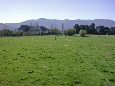
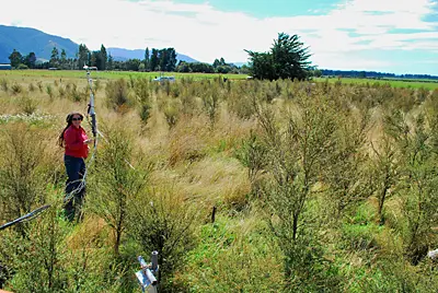
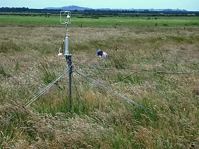
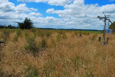
| Description | The Oxford flux site is a 1 hectare block of land located at the NW edge of the Canterbury plains near the foothills, South Island, New Zealand: (GPS coordinates: -43.2619, 172.2108; elevation: 235m). The site is reasonably well watered with only mild summer drought and little winter snow. It started as a fertilized, grazed pasture used to fatten cattle. During the first season it was intensively grazed at monthly intervals through spring to autumn but not during winter. The pasture was dominated by perennial ryegrass, clover and Yorkshire fog. In the winter of 1996, all animals were removed and seedlings of the native trees kanuka (Kunzea ericoidies) were planted at 1 metre intervals. This species occurs locally and is the main invasive tree species after the removal of grazing pressure. There is a mast for meteorological instruments (3m), one for the tree albedo measurements (3m) and one for the main flux measurements (2.1m). Fluxes of water vapour, heat and carbon dioxide are made using a closed path eddy technique. Other measurements include wind speed, wind direction, air temperature, humidity, soil moisture and temperature, incoming and outgoing shortwave radiation and net radiation. We also measure the shortwave albedo, canopy surface temperature, soil temperature and heat flux of pasture (mown), rank grass and kanuka. Soil respiration, tree growth and above ground biomass are measured at monthly intervals. |
| Traditional Owners | — |
| Land Ownership | Private |
| Site history | — |
| Date commissioned | 2005 |
| Data collection period | 2005 - 2008 |
| Environment | |
| IGBP classification | Grasslands (10) initially |
| Vegetation | — |
| Elevation (masl) | 231 |
| Canopy Height (m) | NULL |
| Soil description | Typic Humaquepts |
| Köppen Climate classification | No dry season / warm summer (Cfb) |
| Mean annual temperature (C°) | 10.8 |
| Mean annual precipitation (mm) | 966 |
| Tower operations | |
| Tower type | — |
| Tower height (m) | 2.45 |
| Flux species | CO₂ , H₂O |
| Funding organisation | — |
| Owner organisation | Manaaki Whenua - Landcare Research |
| Principal investigator | John Hunt |
| Technician(s) | — |
| Collaborator(s) | — |
| Point of contact | John Hunt, huntj@landcareresearch.co.nz |
Images of Oxford